

Great Smoky Mountains National Park
- Catherine Cantu
- Nov 12, 2024
- 7 min read
Updated: May 24, 2025
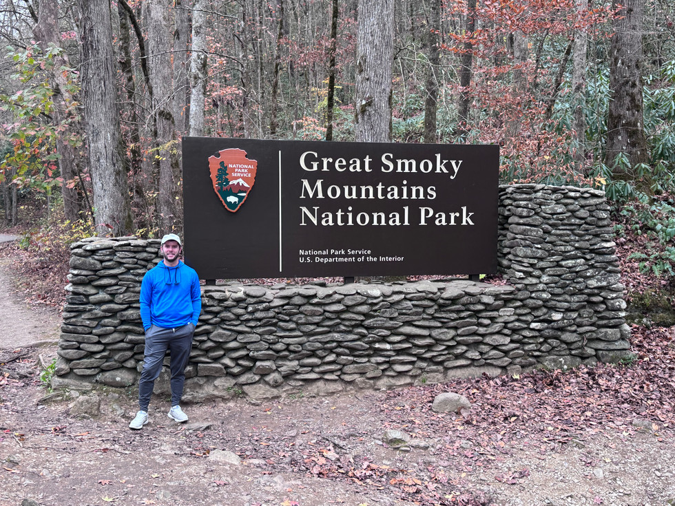
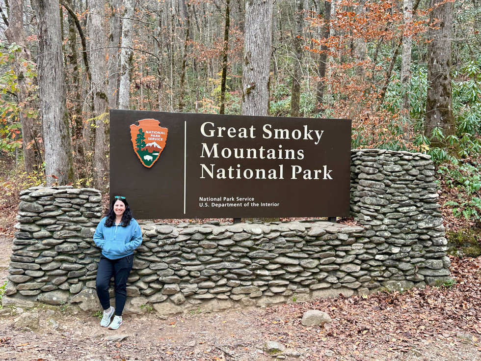
Great Smoky Mountains National Park is the most-visited national park in the United States and spans across portions of North Carolina and Tennessee.

While there isn't an entrance fee, you will need a parking permit if you plan to park somewhere within the national park for longer than 15 minutes. You can purchase a pass for either a day ($5), a week ($15), or 1 year ($40). The park does honor the Free Entrance Days and does not require a parking pass on those dates. You can purchase passes in person at select locations, from kiosks (daily/weekly only), or online (to print - daily/weekly - or to ship - annual).
Before I enter a park, I do a few different things while I still have WiFi. Most parks have little to no cell service, so I like to download offline content. I download offline maps on Google Maps — to do this, open the app and click on your photo in the top right-hand corner. Navigate to offline maps, click on select your own map. Use your fingers to zone in on the national park and click download. I also have the official National Park Service app downloaded on my phone. You can search for the parks you’re visiting, favorite them, and download the relevant park for offline use.
I also use AllTrails. I did pay for AllTrails+ ($35.99/year) this year since my husband and I have been doing a lot of hiking. You can create different lists and then save specific hikes underneath the relevant list. You can also download offline content for specific trails in this app. I always have a few different trails scoped out and the offline content downloaded for each trail I am considering doing.
We recently moved to Knoxville, which means we're roughly an hour from the park. What a dream come true! We've already been multiple times, and I foresee many more visits in our future. We had been getting daily passes from the Great Smokies Welcome Center in Townsend, TN when we were heading to the park, but we've since purchased an annual parking pass.

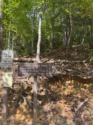
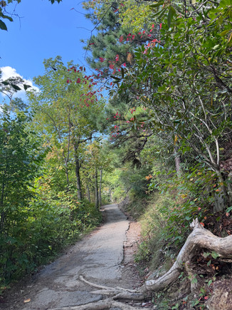
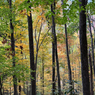
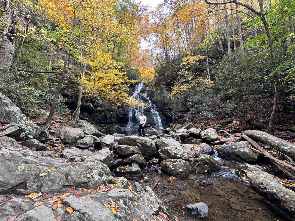
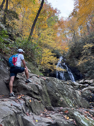
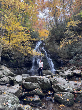
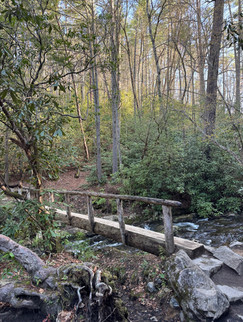
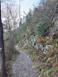
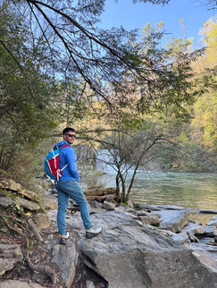
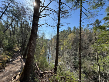
The first time we visited (10/5/24), we set out to hike the Laurel Falls Trail. The trailhead is off of Fighting Creek Gap Road in Sevierville, and it is a really popular trail. NOTE: This trail is currently closed for much-needed renovations for 18 months as of Jan. 6, 2025. We actually had to park a ways away and walk a decent distance to the trailhead because the parking lot at the trailhead was full. There were a lot of people out hiking, but it was still quite enjoyable, and the trail dead-ends at the beautiful 80-foot Laurel Falls. The waterfall is divided in between the upper and lower falls, and the trail will lead you to a cross-bridge at the base of the upper falls. It was early October, and the leaves were ever so slightly beginning to change colors. It was still warm outside, but the trail was very shaded, so I never got too hot. There are no bathrooms at this trailhead (or anywhere nearby), so plan ahead for that.


Distance: 2.4 miles
Trail Type: out-and-back
Difficulty: easy to moderate
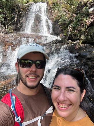
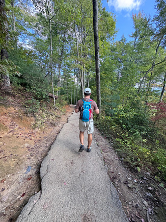
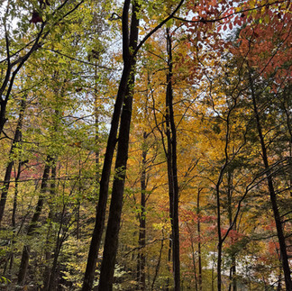
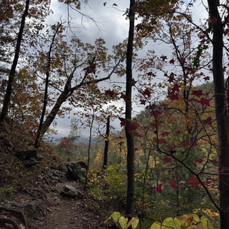
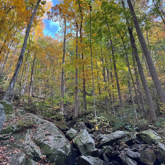
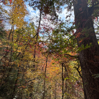
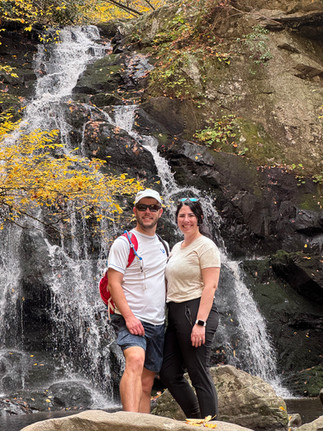
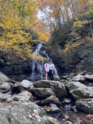
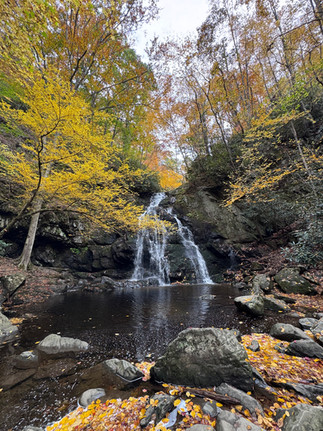
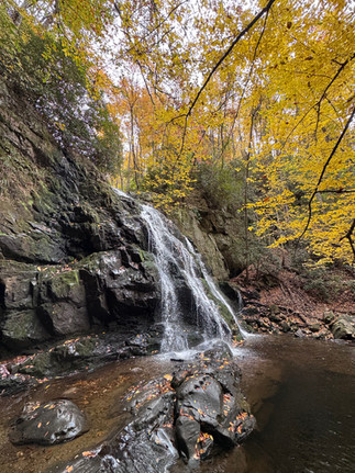
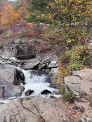
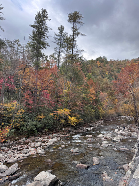
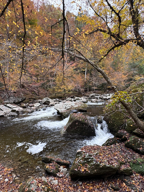
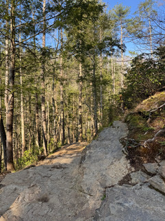
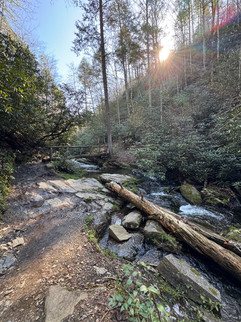
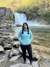
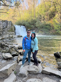
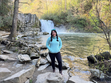
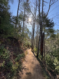
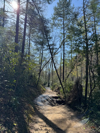
The second time we visited (10/27/24), we set out to hike Buckeye Trail to Spruce Flats Falls. The fall foliage was near peak, the trail was not crowded at all, and it was STUNNING. This was one of my favorite waterfall trails I've done, and I found out about it from a super nice barista at Sunago Coffee in Knoxville who'd overheard me mention that I'd just moved to the area and loved hiking. He gave me a few other trail recommendations that I am hoping to check out in the future. The falls are around 30-feet tall, so I was thinking they might be more on the unimpressive side because I've seen some much larger waterfalls in the last year. I was so wrong - I was blown away, and I would definitely hike this trail again.
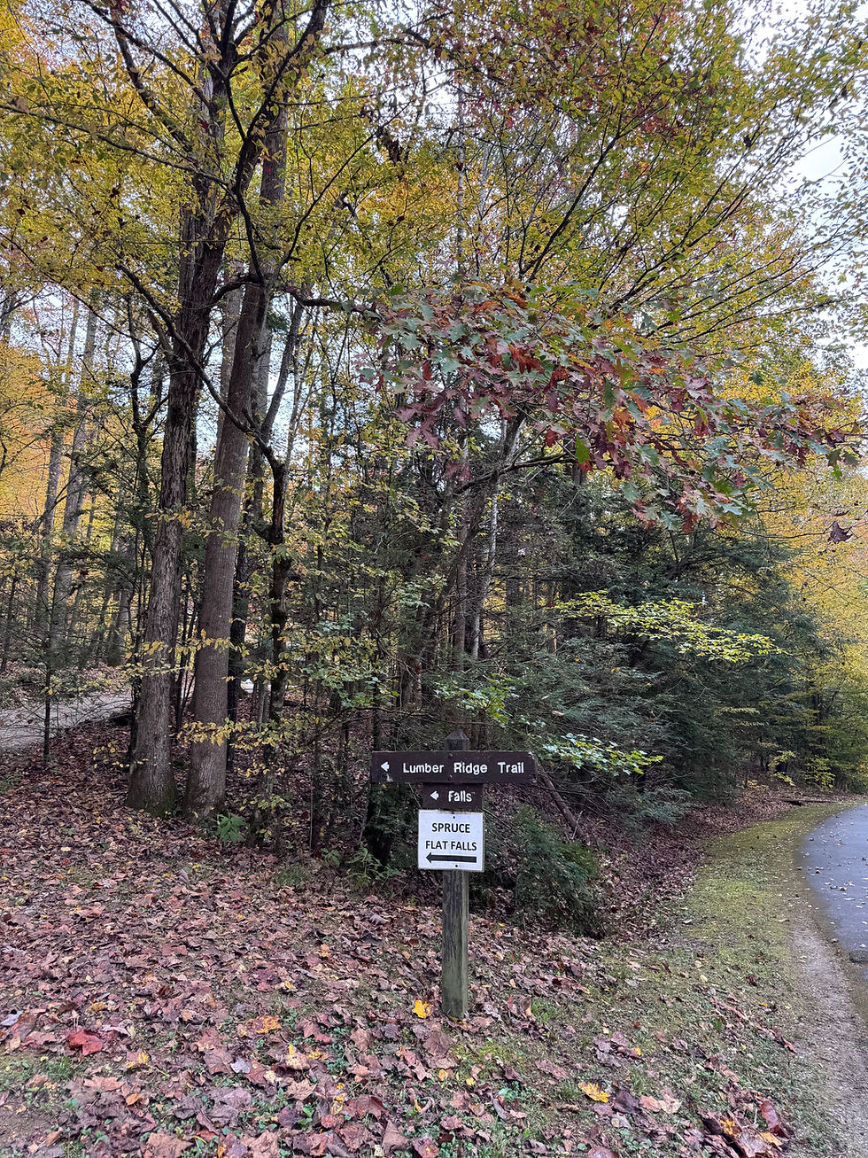
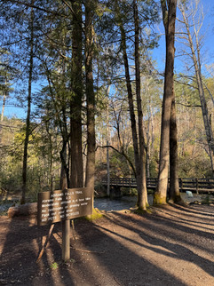
The trail to the falls is not on the official park map, so I would classify this as a hidden gem! From the Townsend Entrance Road, take Laurel Creek Road towards Cades Cove, and turn onto Tremont Road. From there, you'll take a left on GRSM Institute Bridge/Tremont Environmental Education Center Rd. Park at Tremont Visitor Center to access the trailhead. When you're ready to start your hike, you'll look for a wooden sign that says Lumber Ridge Trail. Below it, a paper sign was attached marked with an arrow guiding you to Spruce Flats Falls. There were a few other paper signs marked with directions to Spruce Flats Falls along the trail, so we didn't have any trouble finding our way.


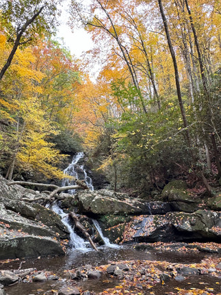

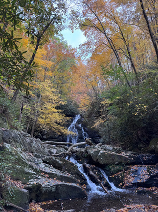


Distance: I'm seeing some differing information when I look up the trail length online. I think I did a great job of starting and ending this hike at the right times in my AllTrails app. The stats it gave me were 1.8 miles (though AllTrails has it marked as 1.6 miles). I think the additional 0.2 miles might come from starting along the Lumber Ridge Trail until you get to Buckeye Trail Junction.
Trail Type: out-and-back
Difficulty: easy to moderate
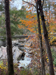
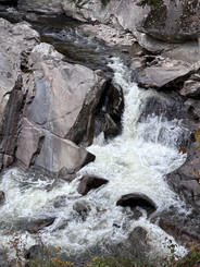
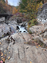
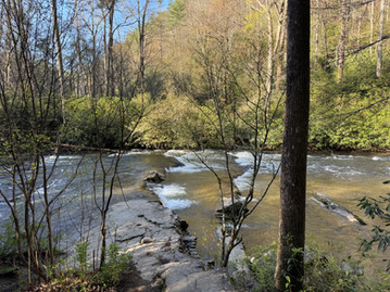
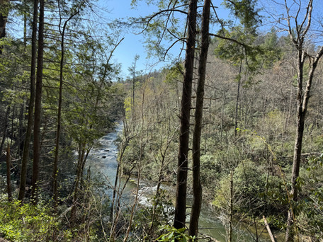
During this visit, we also just drove around some when we finished our hike. We stopped at the Sinks and walked around to take a few photos. The Sinks are located off of the Little River Road scenic drive. In this area, you'll also find the trailhead for Meigs Creek Trail (roughly 7 miles, classified as difficult, with a lot of creek crossings).
Note: If you're visiting during warmer months and you want to swim, the strong currents of the Sinks and the undertow are quite dangerous. The park advises against swimming here because of multiple drownings or serious injury accidents that have occurred.


The park has an abundance of pullouts on the side of the roads for you to stop and get out, stretch your legs, snap a few photos, etc. We stopped at one or two during our second visit.


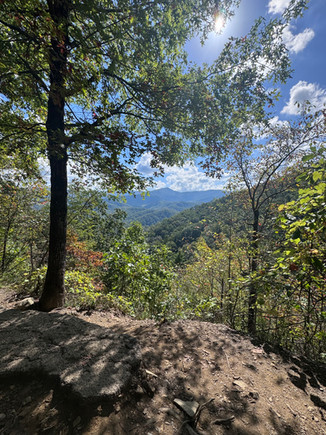
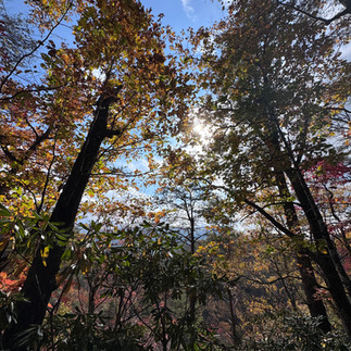
Our third visit on Sunday, November 10, 2024 was just to drive the 11-mile Cades Cove scenic loop. South of Townsend, you'll find an enchanting area of the park called Cades Cove. It's a valley in the park that is surrounded by mountainous views on all sides. The scenic loop is free to drive, and it's a one-way road. If you're wanting to do any of the hikes in Cades Cove, or if you plan to park for an extended period of time, you'll need to get your parking pass before you start the loop. We didn't park anywhere long enough to need the parking pass, but there's a kiosk location for parking tags right before you begin the scenic loop at Cades Cove Orientation Shelter.

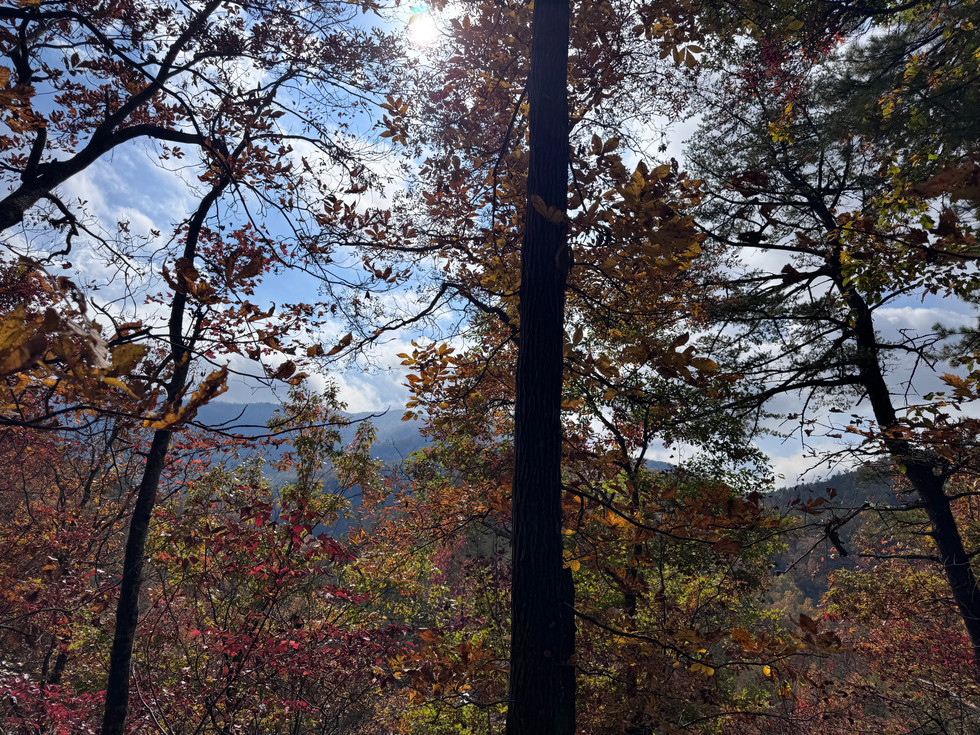
If you plan to do this, allow yourself several hours. Try to be courteous to others enjoying the park and utilize the pullouts if you're wanting to take pictures or view wildlife. If you stop for an extended period of time in the middle of the road, other cars cannot get around you, and you're suddenly creating or contributing to a traffic jam. It took us forever to complete the loop because people would stop for several minutes for what seemed like no reason. It was still very enjoyable and beautiful though! The leaves were past peak fall foliage during this visit, and it was very cloudy.
From what I read, the best time to see black bears is between 6 and 9 am or 5 and 7 pm. We did see one from a distance. If you do encounter any wildlife, please view them from a safe distance of at least 50 yards away. They are wild animals, & you are in their territory and their home. We almost always see wild turkeys when we are visiting the park!

Cades Cove was one of my best friend's father's favorite places. I thought of him when we were driving the loop, and if you find yourself there, I hope you stop for a moment and think of a kind man and loving father named James who left this Earth too soon.


Cades Cove Hours: open from sunrise to sunset
Note: Closed to vehicles every Wednesday (May to September)
On April 13, 2025, my husband and I headed back to Cades Cove to hike the Abrams Falls trail. We didn't have any trouble parking, but we did arrive before 9 am on a Sunday.
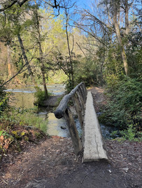
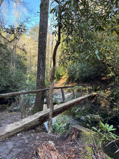
Winter was over, but we were still having some cooler days, especially in the mornings. When we visited, the lush greenery of spring was just beginning. I loved this hike. You're walking alongside a river for the majority, so the sounds of the entire hike are so soothing. I recommend getting an early start because we passed so many people heading to the falls on our way back to the car. We didn't have much difficulty with this one as the elevation gain is gradual; some of the trail can be a bit rocky. The trail isn't paved, so if it's wet out, I'd expect it'd be quite muddy. There are a few creek crossings across log bridges with railings only on one side. The waterfall is not very tall (around 20-feet), but the hike is still worth it, and I thought the falls were beautiful.


Distance: 5 miles Trail Type: out-and-back
Difficulty: moderate


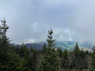
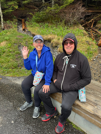
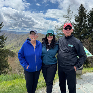
On May 4, 2025, Alex and I headed back to the park, this time with my parents. We had our hearts set on hiking the Kuhowi Observation Tower Trail (formerly known as Clingman's Dome). Last year, the name was changed back to the original Cherokee name with the meaning of "mulberry place."
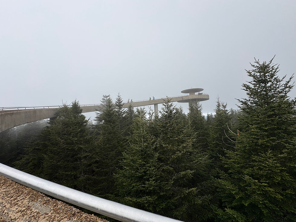
The parking lot for this is around 2 hours and 15 minutes away from Knoxville, so it's a bit of a trek. This area connects the North Carolina side of the park to the Tennessee side via Newfound Gap Road/US 441. Keep in mind that you're heading to the highest point in the park (and the highest point in Tennessee). I highly recommend dressing in layers because the temperature was drastically colder up there. For example, my dad had to buy an additional sweatshirt to wear in the Visitor's Center.


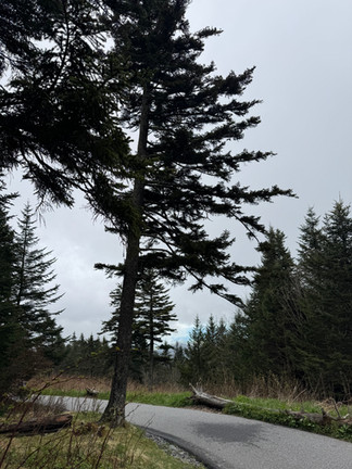


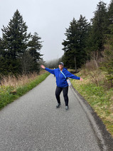

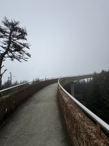


It was a good choice for a hike to do with my parents since the trail is paved, and it's only 1.3 miles. It is a steep climb though, so we just took our time. There are several benches along the trail, so there are plenty of opportunities to stop and catch your breath, if needed.
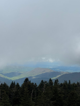
It was so cloudy the day we visited, so visibility was extremely low. I'd love to go back on a clearer day, but these conditions did make for some moody photos.
You'll see a sign for the Appalachian Trail on this hike as it intersects. So fun!
*The road to reach the trail closes seasonally during Winter (usually from December through late March). There are pit toilets in the parking lot for the trailhead here that are closed during Winter.
Distance: 1.3 miles Trail Type: out-and-back
Difficulty: moderate
We stopped at the Newfound Gap Overlook on our way to Gatlinburg where we spent the afternoon before we headed back to Knoxville. The view here is incredible, and I highly recommend stopping if you have time!


https://gamehitclub.it.com/ bữa mình bấm vào xem thử vì thấy bạn bè nhắc, kiểu tò mò xem trang họ làm có gọn gàng không thôi. Ấn tượng đầu là giao diện nhìn khá “sạch”, chữ với các khối nội dung tách ra rõ nên lướt nhanh vẫn hiểu đang nói gì, không bị rối mắt. Mình có kéo xuống đọc đoạn giới thiệu thì thấy họ nhắc mốc ra mắt từ 2015, ít nhất cũng cho người mới biết nguồn gốc chứ không phải vào là toàn nút bấm. Mấy tiêu đề đặt ngay ngắn, nhìn phát biết đang ở phần nào, cuộn trang cũng không bị lạc. Nói chung mình chỉ xem qua chứ không tìm hiểu sâu, nhưng cách…
keonhacai mình thấy bạn bè nói hoài nên tiện tay vào xem thử cho biết. Vào trang cái là thấy bố cục chia mảng khá rõ, nhìn lướt qua vẫn biết chỗ nào là phần thông tin chính, chỗ nào là thanh điều hướng. Mình không ngồi đọc kỹ từng mục, chủ yếu xem trải nghiệm dùng có dễ không thôi. Điểm mình ưng là menu đặt ngay chỗ dễ nhìn, bấm qua lại nhanh, không phải mò mẫm nhiều. Mấy khung bảng thông tin cũng canh hàng cột gọn gàng, chữ thoáng nên đỡ mỏi mắt khi lướt trên điện thoại. Nói chung cảm giác nhẹ nhàng, không bị nhồi quá nhiều thứ một lúc. Mình thích nhất là…
Indonesia had put in an order, and Andy Mattenheimer was assigned to the crew link that would ferry two Albatross airframes from the United States to Southeast Asia for delivery to the Indonesian Air Force. Indonesia, led by the contentious link ruler Suharto at the time, was mostly unknown to everyday Westerners like link Mattenheimer and the crew of three pilots. And, as they would find out, it was nothing like anything they were accustomed to at home.
The "Big Ben" shaped hour and link minute hands as well link as the link off-center small seconds at 2 o'clock are powered by the SMA03-TD caliber, developed and assembled using 162 components in the watchmaker's Neuchâtel workshops.
The Baltic Micro-Rotor. Stainless steel case 36mm x 9.8mm. ELA05MN movement (Made by Hangzhou) with 42 hours link of power reserve. Domed acrylic crystal and exhibition caseback. First batch is numbered set of 200 pieces in each dial link variation. Leather strap. Price: link $630.